Community Overview
Geography
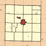
Macomb is located at 40°27′38″N 90°40′27″W / 40.46056°N 90.67417°W / 40.46056; -90.67417 (40.460501, -90.674048).[2] The East Fork La Moine River flows past the northern part of the city.
According to the United States Census Bureau, the city has a total area of 10.2 square miles (26 km2). 9.9 square miles (26 km2) of it is land and 0.4 square miles (1.0 km2) of it (3.90%) is water.
Demographics
| Historical populations | |||
|---|---|---|---|
| Census | Pop. | %± | |
| 1980 | 19,863 | — | |
| 1990 | 19,952 | 0.4% | |
| 2000 | 18,558 | −7.0% | |
| Est. 2009 | 19,748 | Pop Est | 6.4% |
As of the census[3] of 2000, there are 18,558 people, 6,575 households, and 2,952 families residing in the city. The population density is 1,884.2 people per square mile (727.4/km²). There are 7,037 housing units at an average density of 714.5 per square mile (275.8/km²). The racial makeup of the city is 88.73% White, 5.93% African American, 3.06% Asian, 0.03% Pacific Islander, 0.69% from other races, and 1.40% from two or more races. 2.10% of the population are Hispanic or Latino of any race.
There were 6,575 households out of which 19.1% had children under the age of 18 living with them, 34.9% were married couples living together, 7.4% had a female householder with no husband present, and 55.1% were non-families. 38.4% of all households were made up of individuals and 12.4% had someone living alone who was 65 years of age or older. The average household size was 2.10 and the average family size was 2.77.
In the city the population was spread out with 12.6% under the age of 18, 42.9% from 18 to 24, 18.2% from 25 to 44, 14.0% from 45 to 64, and 12.4% who were 65 years of age or older. The median age was 23 years. For every 100 females there were 94.3 males. For every 100 females age 18 and over, there were 93.8 males.
The median income for a household in the city was $25,994, and the median income for a family was $42,069. Males had a median income of $27,663 versus $21,780 for females. The per capita income for the city was $13,470. 29.1% of the population and 12.2% of families were below the poverty line. 22.8% of those under the age of 18 and 8.1% of those 65 and older were living below the poverty line.
History
Origin
First settled in 1829 on a site tentatively named Washington, the town was officially founded in 1830 as the county seat of McDonough County and given the name Macomb after General Alexander Macomb, a general in the War of 1812. War veterans were given land grants in the Macomb area, which was part of the "Military Tract" set aside by Congress. In 1855 the Northern Cross Railroad, a predecessor to the Chicago, Burlington and Quincy Railroad, was constructed through Macomb, leading to a rise in the town's population. In 1899 the Western Illinois State Normal School, later Western Illinois University, was founded in Macomb. Representative Lawrence Sherman was instrumental in locating the school in Macomb.[4] In 1903 the Macomb and Western Illinois Railway was built from Macomb to nearby Industry and Littleton by local financier Charles V. Chandler, though this railroad was abandoned in 1930. In 1918, construction on Illinois Route 3 was begun as a state financed highway from Cairo to Rock Island through Macomb; in the late 1920s U.S. Route 67 was extended along this route to Dubuque, Iowa.
Presidential visits
Macomb has been visited by several US Presidents over the years. Ulysses S. Grant, Andrew Johnson, Rutherford B. Hayes, William McKinley and Theodore Roosevelt have all made short addresses in Macomb. On two occasions, Abraham Lincoln and Barack Obama addressed large audiences prior to their election as president. Obama was actually stumping for state senate at the time, meaning a president or presidential nominee has not visited Macomb in 109 years and counting.[5]


